

Navigating the Website
How could I obtain a quick overview of do-it-yourself redistricting?
Explore these options for spending fifteen minutes to an hour learning about redistricting.
Watch the GeoCivics Introduction (45 minutes), which overviews "On the Move" lessons and population change, considers the redistricting process and criteria, then describes and demonstrates online mapping tools.
Watch this one-hour video from Draw The Lines PA discussing what issues matter to you, how Americans choose their representatives, the decennial census, apportionment and redistricting, approaches to and impacts of gerrymandering, and how to make a map.
Watch the TEDx talk, Redistricting of the people, by the people, and for the people from April 2019.
Investigate population changes in your state over time using "On the Move" lessons for each state, available on the State Resources page. Gather paper maps and stackable objects to represent three or four different time periods. Using National Geographic Giant State Maps? Watch a demonstration with the Ohio map ( at 31 mins) or in North Carolina (at 4 mins, 30 secs).
Learn about the importance of geospatial technology and GIS to the redistricting process. Explore the approach Thomas Hofeller took to drawing electoral districts.
Use resources to explain concepts about governing and representation which may cause confusion.
Visit the State Resources pages to find the State ArcGIS Online Redistricting Exercises and sites such as DistrictR to draw your own electoral district maps.
Complete this survey to share your experience.
What can I access through this website?
You will find state-specific resources designed to provide a foundation for discussing topics related to the decennial census, the responsibility for and execution of electoral redistricting, and the implications for choices made about how to draw district lines. National, state, and local resources are also available to explore topics related to apportionment and redistricting, including international and historical approaches to redistricting, gerrymandering, voter participation, and related litigation. Organizations in your state may be able to provide additional connections with educators and community members.
What can I find on the "State Resources" page?
This is the first place to visit to begin understanding specifics of the redistricting process in a particular state.
To demonstrate movement of the population and provide historical perspective, explore an "On the Move" lesson for your state. The lesson identifies the fifteen largest cities in each state over four time periods using census data, ending in 2020. This lesson can be used with National Geographic's Giant State Maps and cones or with tabletop paper driving maps and stackable items, such as buttons or LEGOs.
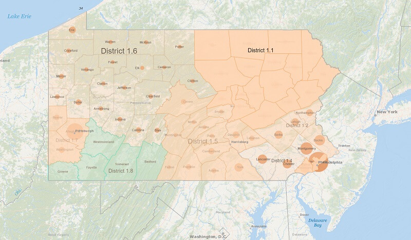
State Resources pages provide an opportunity for students and community members to create their own electoral district maps; each state with more than one congressional district has an ArcGIS exercise allowing the construction of districts by county. The State Resources pages also feature selected organizations and contacts related to each state.
What instructional materials are available?
Visit the Teacher resource page for lesson plans.
A background PowerPoint presentation can be altered to suit any audience. If you are presenting to a group already familiar with apportionment and redistricting, you may want to provide a short refresher to ensure everyone begins the discussion with the same base of knowledge. If you are using the state "On the Move" and "ArcGIS Online Redistricting Exercise" materials as part of a class, you may want to prepare a more extensive review of each of the topics covered. Assessment questions are also available.
A video of the National Geographic Giant Map of North Carolina (15 minutes) provides an example of how this map resource can be utilized in the classroom and how the "On the Move" lessons are executed. Rebecca Theobald demonstrates the activity in the instructional video National Geographic Giant Map of Ohio Comes to Sinclair (3 minutes) and in the overview (45 minutes) of the GeoCivics project.
What can I find on the other pages of GeoCivics?
The Redistricting, Geography, and Civics pages are great places to start learning about these topics. Each page houses resources, created by a multitude of organizations, that address issues surrounding civics education and good governance. Mapping applications are essential to the conversation about redistricting and can be found under Geospatial Technology in Geography.
I'm a teacher, college instructor, student, community member . . .
Choose your specific role while navigating the GeoCivics site, taking advantage of the opportunities and resources available in a manner best suited to your own intentions and learning.
Whom should I contact for more information?
Email Rebecca Theobald at rtheobal@uccs.edu or call her at 719-255-5217.
Explore and Engage to Learn about Redistricting
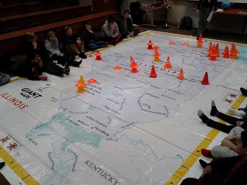
In GeoCivics "On the Move" lessons, use National Geographic's Giant State Maps to build the foundation of the apportionment and redistricting process.
Unable to access a Giant Map?
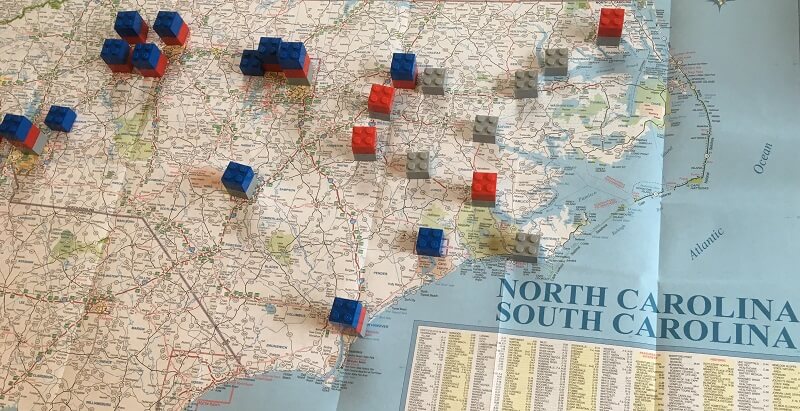
A small AAA paper driving map with LEGOs can also be used for the "On the Move" lesson and other interactive mapping activities.
United States Decennial Census and Representation
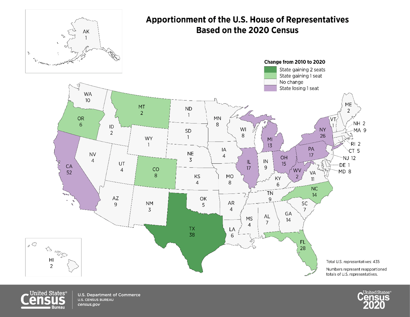
Apportionment is the first step in figuring out how many people will be represented by legislators in each state.
Geospatial Technology
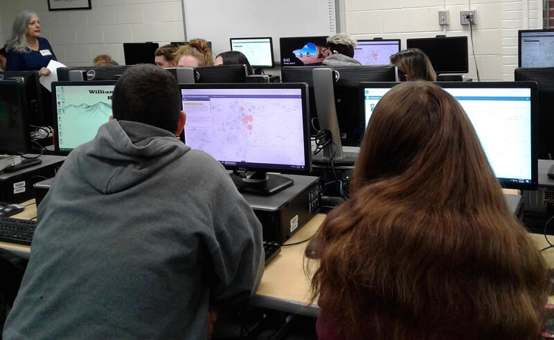
Make your own map to learn about apportionment and redistricting through the ArcGIS Online Redistricting Exercise for each state.
Reasonable Maps of Districts
How can we arrive at a map of fairly divided districts? Investigate further through GeoCivics geospatial technology tools.